Active vacation

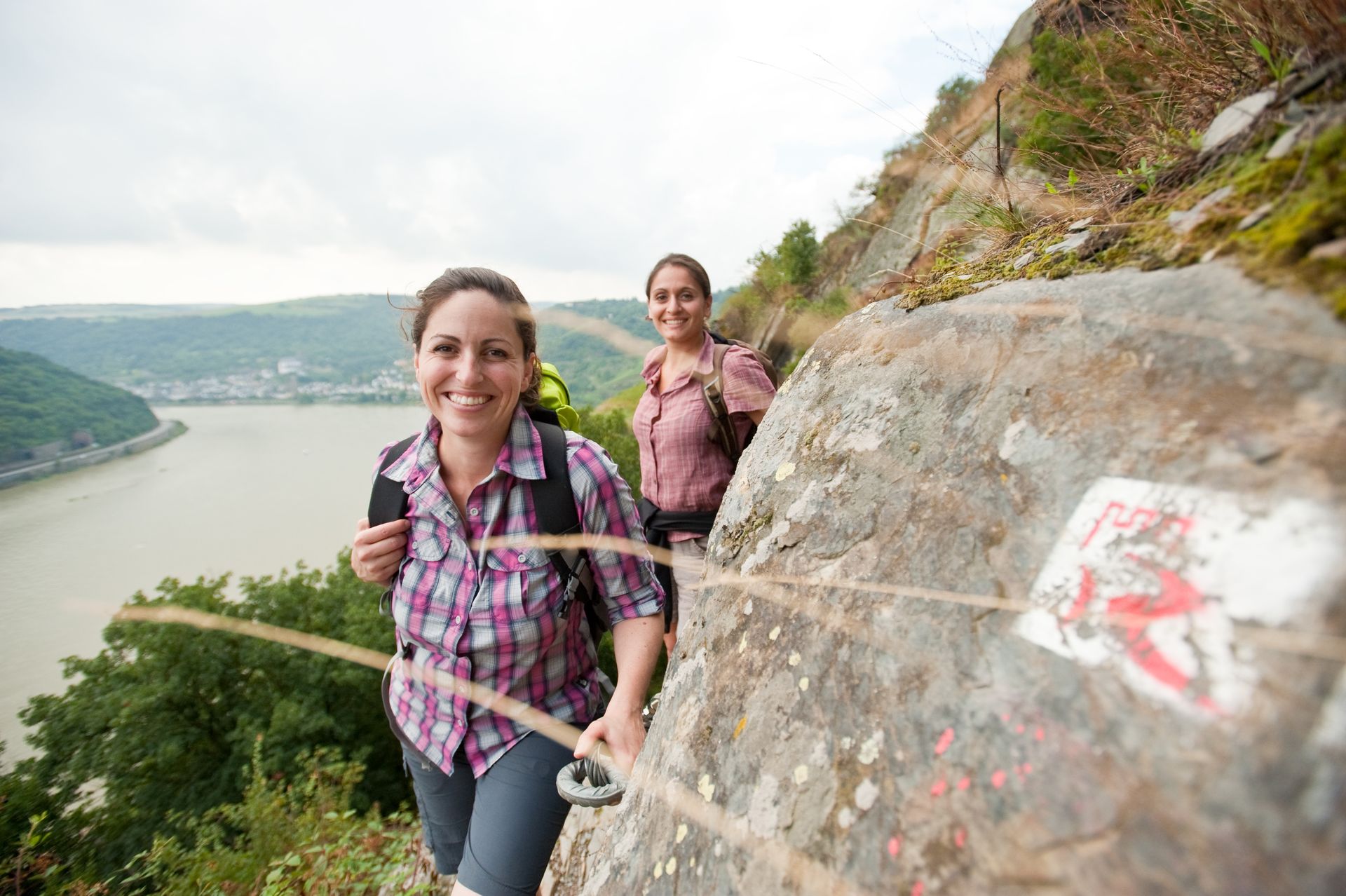
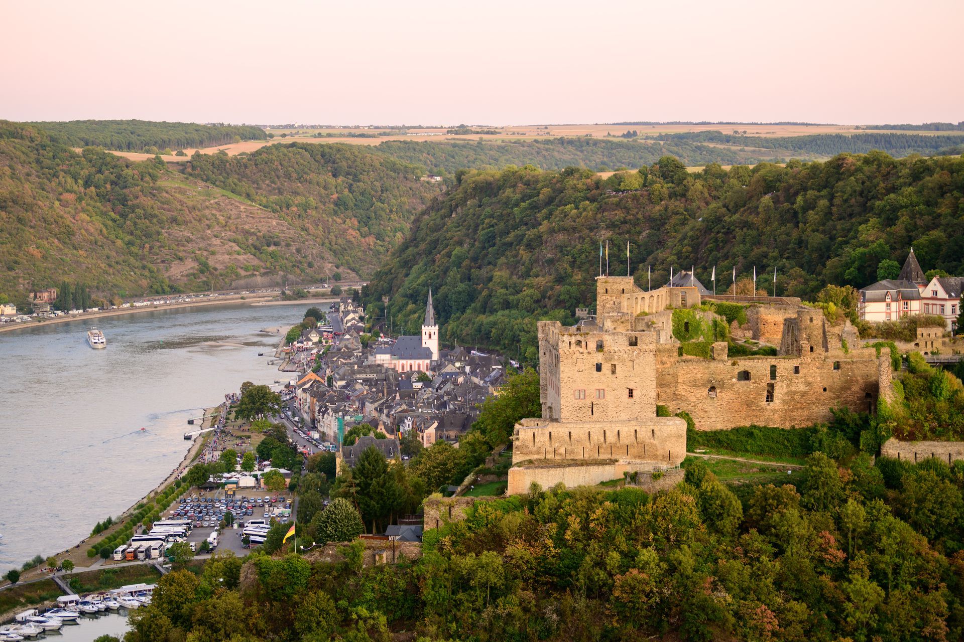
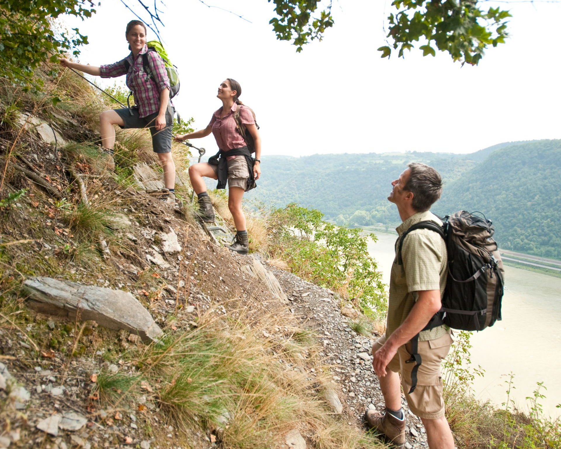
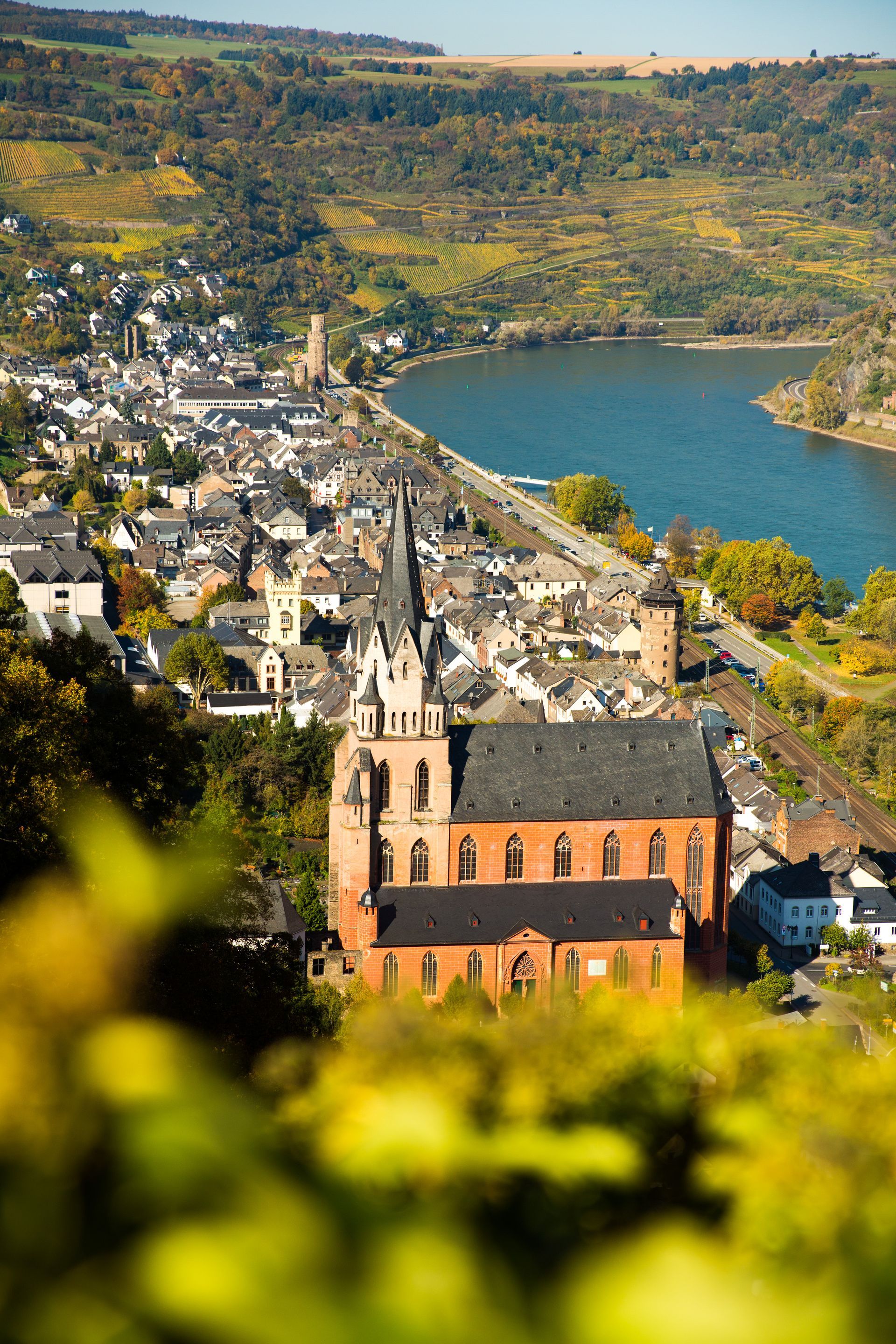
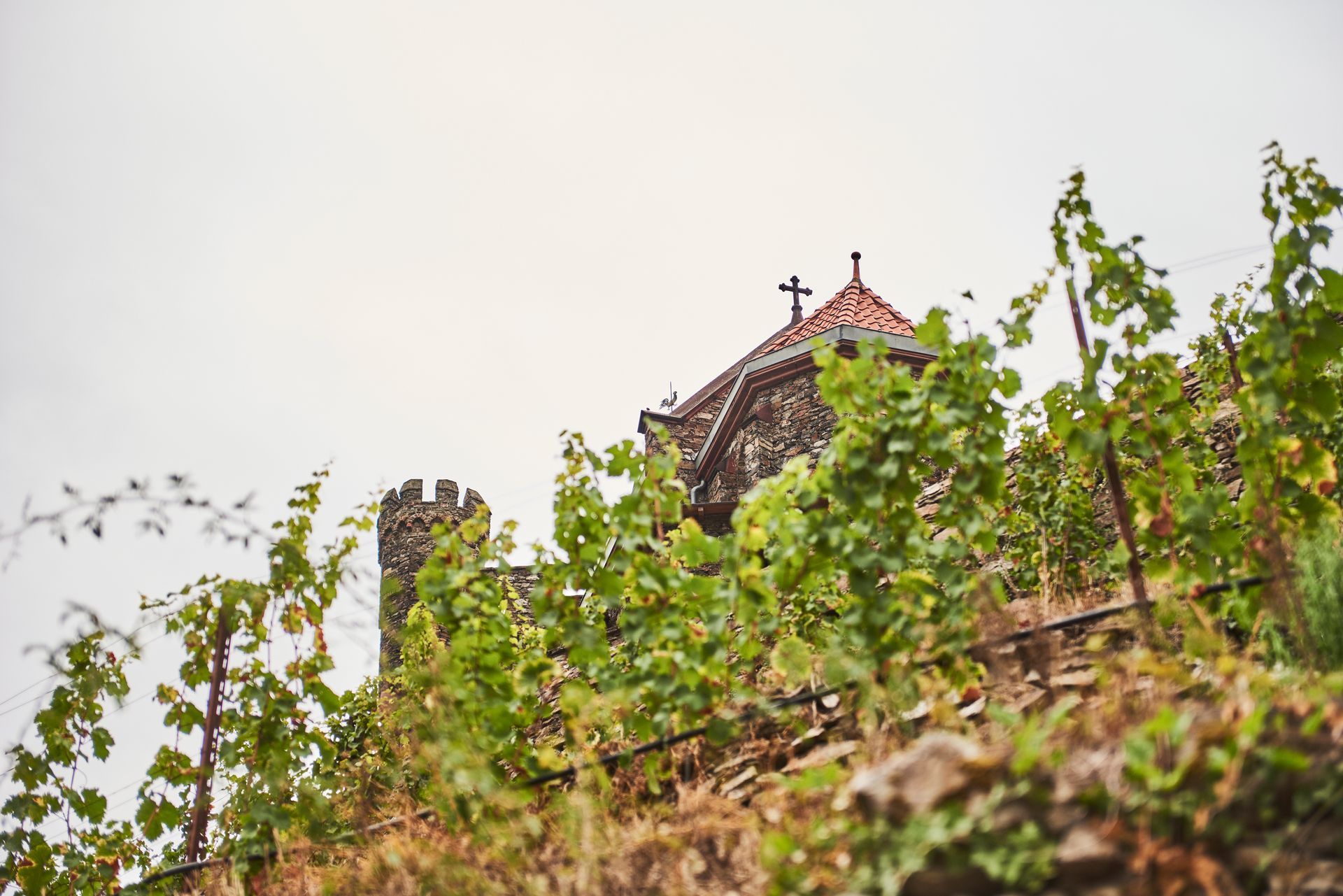
Around Reichenstein Castle, you'll find a variety of hiking trails winding through the unique landscape of the Middle Rhine Valley.


Whether you’re taking a short stroll or a longer hike, you’ll always be treated to stunning views of the Rhine and the slate mountains. Popular destinations include the romantic Morgenbach Valley and family-friendly loop trails in the Binger Forest.

Hikes curated by us

Schweizerhaus Circuit

Distance: 12.2 kilometers

Two map markers placed side by side, connected by a dashed horizontal line.

12.2 km

A black-and-white clock icon showing the time as 4 o'clock.

approx. 3:55

A line drawing of a mountain with a snow-capped peak and a vertical double arrow next to it.

↑ 624 ↓569

Gerhardshof Circuit

Distance: 9.8 kilometers

Two map markers connected by a horizontal dotted line.

9.8 km

A black-and-white clock icon showing the time as 4 o'clock.

approx. 3 hours

A simple line drawing of a mountain with a snow-capped peak and a vertical double arrow next to it.

↑395 ↓395

Donkey Trail

Distance: 4 kilometers

Two map markers placed side by side, connected by a dashed horizontal line.

4 km

A simple black line drawing of an analog clock face set to 4:00.

approx. 1 hour 20 minutes

A simple black outline icon of a snow-capped mountain peak next to a vertical double arrow.

↑219 ↓219

To the Kölschwiese

Distance: 7.8 kilometers

Two map markers connected by a horizontal dotted line.

7.8 km

A simple black line drawing of an analog clock face set to 4:00.

approx. 2.5 hours

A simple line symbol of a snow-capped mountain peak next to a vertical double arrow indicating the elevation.

↑437 ↓268

To the Hail Cross

Distance: 3.6 kilometers

Two map markers connected by a horizontal dotted line.

3.6 km

A black-and-white icon of an analog clock showing the time as 4:00.

approx. 1 hour and 15 minutes

A line drawing of a mountain with a snow-capped peak and a vertical double arrow indicating its height.

↑210

↓210

Trechtingshausen City Tour

Distance: 1.6 kilometers

Two map markers connected by a horizontal dotted line.

1.6 km

An analog dial showing the time as approximately 4:00.

approx. 12:30 a.m.

A simple line drawing of a mountain with a snow-capped peak and a vertical double arrow indicating its height.

↑50

 ↓50

More routes around the Middle Rhine Valley

Stahlberg Loop

Distance: 12.7 kilometers

Two map markers connected by a horizontal dotted line.

12.7 km

A simple line drawing of an analog clock face set to four o'clock.

about 4 hours

A black outline icon of a snow-capped mountain next to a vertical double arrow.

↑550 ↓550

Loreley "Wine Trail" and Leiselfeld

Distance: 6.3 kilometers

Two map markers connected by a horizontal dotted line.

6.3 km

A black-and-white drawing of an analog clock set to four o'clock.

about 2 hours

A simple black line drawing of a mountain with a snow-capped peak, accompanied by a vertical arrow indicating its height.

↑149↓147

In Vino Veritas

Distance: 9.5 kilometers

Two adjacent position markers connected by a horizontal dashed line.

9.5 km

An analog clock icon showing the time 4:00.

approx. 3 hours

A simple black-and-white icon of a snow-capped mountain peak next to a vertical double arrow.

↑369 ↓369

Enjoy the Rhine by bike

The Rhine Cycle Route between Bingen and Koblenz offers many sights. Starting in Trechtingshausen, you’ll cycle past Hohneck Castle and the Fürstenberg Castle ruins on your way to Bacharach and Stahleck Castle. Around Trechtingshausen, there are numerous cycling routes for both athletic cyclists and leisure riders. Near Reichenstein Castle, the cycling tours are often loop routes, with plenty of places to stop for refreshments and wine taverns.

Rhine Cycle Route: Bingen – Bacharach

Distance: 14.5 kilometers

Two map markers connected by a dashed horizontal line represent a distance or a route between two locations.

14.5 km

A black-and-white clock icon set to 4 o'clock.

approx. 0:58

A simple black-and-white icon of a snow-capped mountain peak with a vertical arrow next to it.

↑23 ↓31

Cross-Rhine Bike Tour

Distance: 39.1 kilometers

Two markers on the map connected by a dotted line.

39.1 km

A simple black-and-white icon of a clock showing 4 o'clock.

approx. 4.5 hours

A black-and-white icon of a snow-capped mountain peak next to a vertical double arrow representing altitude.

↑149 ↓149

Loreley Bike Tour: Hunsrück–Middle Rhine

Distance: 44.3 kilometers

Two map markers connected by a horizontal dotted line.

44.3 km

A simple black line drawing of an analog clock showing 4 o'clock.

approx. 5 hours

A simple line symbol of a snow-capped mountain peak next to a vertical double arrow indicating the elevation.

↑173 ↓572

The Middle Rhine Valley on the "
" e-bike


Explore this UNESCO World Heritage Site with ease on our e-bikes! | ➔ Prices Ask about our rental bikes when you make your reservation. We’d be happy to reserve an e-bike for you for the dates you’d like. If you’d like to bring your own bike, you can store, maintain, and charge it for free at our bike service station.

High Up – The Via Ferrata Routes in the Area

If you’re looking for a bit more action and a physical challenge, we highly recommend the via ferratas in the Upper Middle Rhine Valley. As you climb, you’ll get up close to the sometimes dramatically steep walls of the Rhenish Slate Mountains. The varied via ferrata routes, with their different levels of difficulty, are suitable for both beginners and advanced climbers—and offer spectacular views of the Rhine Valley.


The Mittelrhein Via Ferrata Dream Loop

Distance: 4.9 kilometers

The Middle Rhine Via Ferrata is located in Boppard, on the most scenic bend of the Rhine. It winds through the unique steep slopes along the Rhine and offers spectacular views of the Rhine Valley and the Hunsrück. The challenging route features a total of 11 climbing sections on steep rock faces.

Two map markers connected by a horizontal dotted line.

4.9 km

A black-and-white icon of a round clock showing the time as 4:00.

approx. 2.5 hours

A simple line-art icon of a mountain with a snow-capped peak and a double-headed vertical arrow indicating the height.

↑149 ↓149

Rabenacksteig in St. Goarshausen

Distance: 1.4 kilometers

Here you can enjoy breathtaking views of the Rhine Valley, including the Katz and Maus castles and the town of Sankt Goarshausen with its world-famous Loreley.

Two map markers connected by a horizontal dashed line represent a distance or a route.

1.4 km

An analog clock icon with the hands pointing to 4 o'clock.

approx. 0:50

A line drawing of a mountain with a snow-capped peak next to a vertical double arrow indicating the height.

↑200 ↓92

Middle Rhine Via Ferrata in Boppard

Distance: 5.6 kilometers

The Middle Rhine Via Ferrata Boppard is a hike with easy via ferrata sections above the "Traumschleife" on the Rhine; at the start, the via ferrata passages lead over small rock faces, mostly downhill (ladders); some rock faces are secured with wire ropes and footholds and are somewhat exposed in places, and can get very warm in the sun.

Two map markers connected by a horizontal dotted line.

5.6 km

A black image of a clock with the hour hand pointing to 12 and the minute hand pointing to 4, indicating that it is 12:20.

approx. 3 hours

A simple black outline icon of a snow-capped mountain peak with a vertical measurement arrow next to it.

↑590 ↓590

A coat of arms featuring three figures in dynamic poses above a shield divided into vertical red and white stripes.